Now Reading: The Basics of Wilderness Cartography: Making Your Own Maps
-
01
The Basics of Wilderness Cartography: Making Your Own Maps
The Basics of Wilderness Cartography: Making Your Own Maps
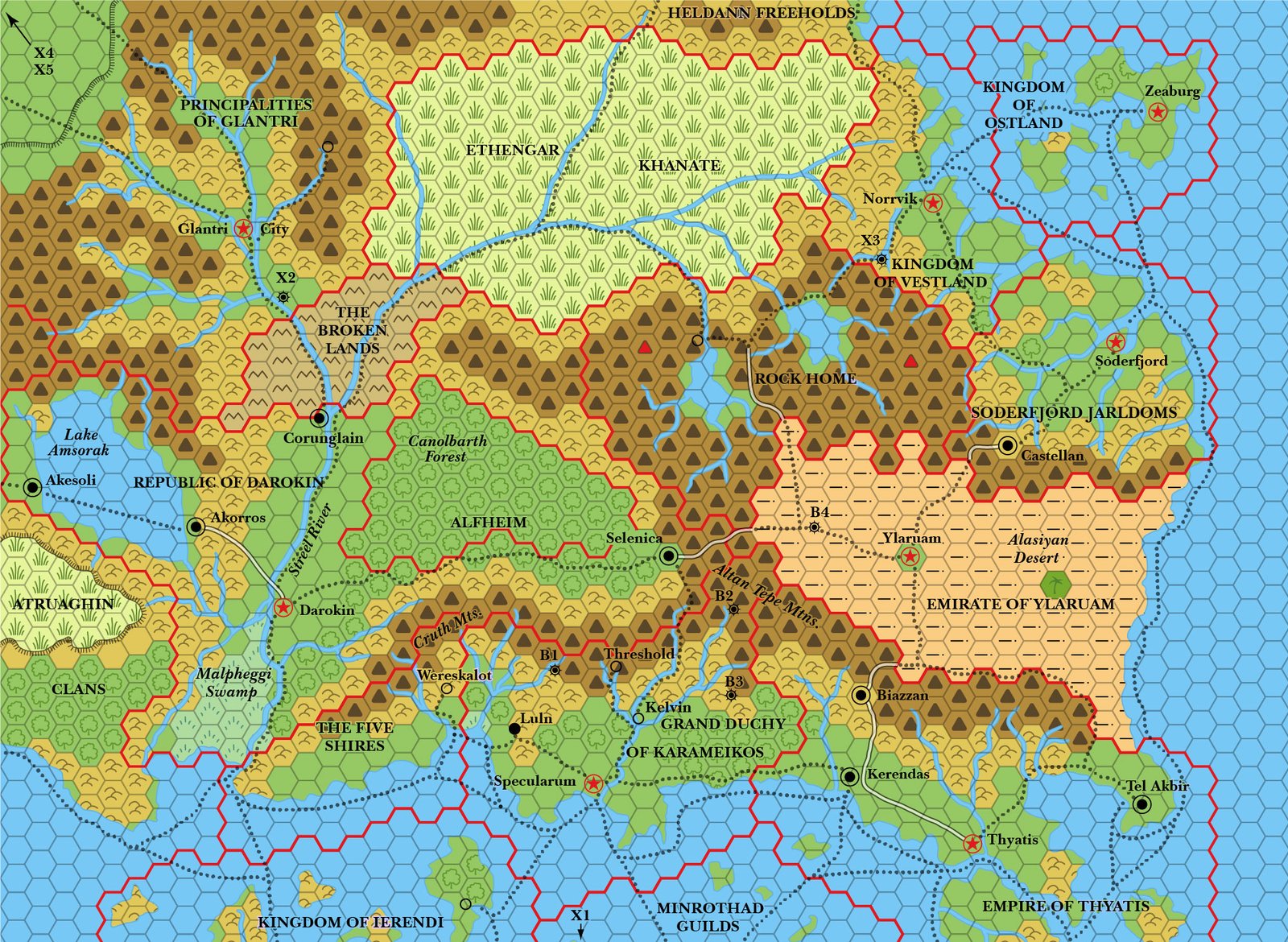
The untamed wilderness, with its sprawling landscapes and hidden treasures, has a way of captivating our adventurous spirits. Yet, venturing into these remarkable terrains without a map can be akin to embarking on a journey blindfolded. Fear not, intrepid explorer! In this guide, we will unravel the enigmatic world of wilderness cartography, revealing the art and science behind creating your very own maps. So, grab your compass, sharpen your pencils, and let’s embark on an extraordinary expedition to unlock the secrets of map-making in the great outdoors.
Table of Contents
- The Lay of the Land: Understanding the Importance of Wilderness Cartography
- Mapping Tools and Techniques: Essential Gear for Creating Accurate Wilderness Maps
- From Field Notes to Works of Art: Techniques for Capturing Wilderness Features on Paper
- Choosing the Right Scale: An In-depth Analysis of Wilderness Map Scales
- Navigating the Wild: Tips for Using Your Self-made Wilderness Maps
- Q&A
- Insights and Conclusions
The Lay of the Land: Understanding the Importance of Wilderness Cartography
When exploring the great outdoors, it is essential to have a reliable guide that can lead us through the wilderness maze. Enter wilderness cartography – the art and science of mapping and understanding the lay of the land. It goes beyond a simple map; it is a tool that unlocks the secrets hidden in the mountains, forests, and rivers. Wilderness cartography empowers adventurers to navigate with confidence, uncovering an array of treasures and experiences that might otherwise be missed.
The importance of wilderness cartography cannot be overstated. It not only helps us avoid getting lost but also enables us to plan our journeys effectively. With accurate maps, we can identify the most scenic trails, avoid dangerous terrain, and discover hidden gems along the way. Wilderness cartographers use sophisticated techniques to capture the lay of the land, including GPS data, aerial imagery, and topographic surveys. These maps provide a detailed understanding of the terrain, elevation, water sources, and potential hazards that lie ahead. They become our companions, guiding us through vast stretches of wilderness and ensuring our safety throughout our adventures.
Wilderness cartography also plays a vital role in environmental stewardship. A well-drawn map can highlight protected areas, sensitive habitats, and essential landmarks. This knowledge empowers us to tread lightly, respecting the delicate balance of nature. By knowing where boundaries lie and which areas require special protection, we can make informed decisions about how to interact with our surroundings in a sustainable manner. Wilderness cartography thus serves as a bridge between exploration and conservation, fostering a deeper appreciation for the natural world and encouraging responsible outdoor recreation.
Why Wilderness Cartography Matters:
- Essential for navigation and avoiding getting lost
- Aids in planning memorable and safe journeys
- Reveals hidden treasures and scenic trails
- Provides a comprehensive understanding of the terrain and potential hazards
- Guides responsible outdoor exploration and conservation efforts

Mapping Tools and Techniques: Essential Gear for Creating Accurate Wilderness Maps
When it comes to mapping the wilderness, having the right tools and techniques at your disposal can make all the difference between a mediocre map and one that is truly accurate and reliable. Whether you are an avid hiker, a seasoned explorer, or a professional cartographer, equipping yourself with the essential gear is essential to ensure precision in your mapping endeavor.
1. GPS Devices: Investing in a high-quality GPS device is paramount for accurate wilderness mapping. These devices use satellite signals to pinpoint your exact location, allowing you to accurately plot your path and create reliable maps. Look for a device with advanced features such as waypoint navigation and a built-in compass to further enhance your mapping capabilities.
2. Mapping Software: While pen and paper may be the go-to method for traditional mapping, modern cartographers are turning towards digital solutions. Mapping software provides a vast array of tools and features that simplify the mapping process. It allows you to effortlessly draw and edit maps, measure distances, and overlay different layers of data. Some popular mapping software options include ArcGIS, QGIS, and Google Earth Pro.
3. Topographic Maps: While GPS devices and mapping software are indispensable, having a reliable topographic map as a backup is always wise. Topographic maps provide a wealth of information, including elevation, contour lines, and natural or man-made features. They serve as a valuable reference point and can help validate the accuracy of your digital mapping efforts.
By utilizing these essential tools and techniques, you will be well-equipped to undertake the challenge of creating accurate wilderness maps. Remember, precision and attention to detail are key, as every twist and turn of the terrain can impact the accuracy of your final product. So, arm yourself with the right gear, harness your creativity, and let the adventure of mapping the wilderness begin!
From Field Notes to Works of Art: Techniques for Capturing Wilderness Features on Paper
Embarking on an adventure into the wilderness is a journey of exploration and discovery. Whether you’re a seasoned artist or a nature enthusiast hoping to express the beauty encountered on your expeditions, capturing the essence of these wild landscapes on paper can be both challenging and rewarding. Here are some techniques to help you transform your field notes into exquisite works of art:
- Observe with intent: Immerse yourself in the surroundings and carefully observe every detail – the way sunlight filters through leaves, the intricate patterns of animal tracks, or the interplay of colors in the sky at dawn. Train your eyes to notice the subtleties that make each wilderness feature unique and remember to capture the intangible atmosphere.
- Experiment with mediums: Don’t limit yourself to just a pen and paper. Explore different artistic mediums such as watercolors, pastels, or charcoal to breathe life into your sketches. Experiment with texture, layering, and shading techniques to convey the depth and richness of the natural landscapes you encounter.
- Create a visual narrative: Rather than focusing solely on individual elements, try to tell a story through your artwork. Connect the dots between different features, emphasizing the relationships and interactions that bring the wilderness alive. Let your pen stroke or brush communicate the sensations, sounds, and emotions experienced in these untamed environments.
Remember, capturing wilderness features on paper is not just about replicating what you see. It is about creating a personal interpretation that resonates with your experiences and conveys the awe-inspiring beauty of nature to others. So grab your sketchbook, venture into the unknown, and let your artistic journey begin!
Choosing the Right Scale: An In-depth Analysis of Wilderness Map Scales
When it comes to wilderness maps, choosing the right scale is crucial for a successful adventure. In this in-depth analysis, we will explore different map scales and their significance in navigating the great outdoors.
Firstly, let’s discuss the importance of scale. The scale of a map represents the relationship between the distances on the map and the corresponding distances in the real world. It helps determine how much detail is shown and how accurately features are represented.
There are various map scales to choose from, each with its pros and cons. Here are some commonly used scales:
- 1:24,000 scale: Also known as the 7.5-minute map, this scale is widely used in the United States and provides a high level of detail. It is ideal for close-up exploration, especially for hikers and backpackers.
- 1:50,000 scale: Commonly used in many countries, this scale strikes a balance between detail and coverage. It is suitable for a wide range of outdoor activities, such as camping, hunting, and fishing.
- 1:100,000 scale: This scale offers a broader view of the landscape, making it useful for planning long-distance routes or gaining an overview of a larger area. However, it may lack specific details required for more precise navigation.
Ultimately, the choice of map scale depends on the nature of your adventure and your specific needs. It’s worth considering the terrain, the level of detail required, and the extent of your exploration. So, next time you embark on a wilderness journey, remember to carefully analyze the map scales to ensure a safe and enjoyable experience!
Navigating the Wild: Tips for Using Your Self-made Wilderness Maps
Heading off into the wilderness armed with your very own hand-drawn map can be an exhilarating adventure. While it may lack the precision of a professionally made guide, your self-made wilderness map holds its own unique charm and unknown treasures. Here are a few tips to help you make the most of your handcrafted cartographic masterpiece:
– **Double-check the key landmarks**: Before setting off on your expedition, study your map carefully. Identify the key landmarks you have marked, such as mountains, rivers, or distinctive trees. Take note of any additional details you may have included, like hidden caves or secret meadows. Familiarize yourself with these landmarks, as they will serve as your guiding points during your journey.
– **Trust your instincts but keep an eye on the compass**: As you venture into uncharted territory, it’s essential to trust your instincts. Often, your intuition will guide you where your map cannot. However, always remain aware of your compass heading. Remember, nature can be unpredictable, so a sense of direction can be a life-saver in an unfamiliar landscape.
– **Leave your mark**: While exploring the wilderness, leave subtle markers along your path to enrich your map. These markers can be as simple as arranging rocks, tying colored ribbons, or building small cairns. Document these markers on your map to assist future adventurers who may stumble upon your hand-drawn guide.
Remember, self-made wilderness maps are not just navigational tools; they are a window into your own unique perspective of the wild. So, embrace the untamed beauty, trust in your map, and let it guide you to unforgettable experiences in the heart of nature.
Q&A
What equipment is necessary for wilderness cartography?
To create your own maps in the wilderness, you will need a compass, topographic maps, a pencil, ruler, a GPS device, and a notepad for recording observations. It is also recommended to carry a camera for capturing reference images.
How can a GPS device be useful in wilderness cartography?
A GPS device is an essential tool for wilderness cartography as it helps you accurately record your location, waypoints, and tracks. By utilizing GPS technology, you can accurately plot your observations and create more precise maps.
Why are topographic maps important for wilderness cartography?
Topographic maps provide essential information about the physical features and terrain of an area, including elevation, water bodies, and forests. These details are crucial for creating accurate and reliable maps in the wilderness.
Can I rely solely on my observations while making wilderness maps?
While personal observations are valuable, it is essential to augment them with other sources, such as topographic maps and GPS data. Combining multiple data points ensures the accuracy and reliability of your wilderness maps.
How can I choose the best pencil for wilderness cartography?
When selecting a pencil for wilderness cartography, it is recommended to use a mechanical pencil with HB lead. Mechanical pencils do not require sharpening, and HB lead provides a good balance between darkness and durability, making it ideal for field use.
What are some important tips for accurate wilderness cartography?
To ensure accuracy, always take frequent GPS readings and cross-reference them with your topographic maps. Additionally, verify your observations using recognizable features or landmarks to minimize errors in your mapmaking.
Why is it necessary to create your own maps in the wilderness?
Creating your own maps in the wilderness allows you to have a firsthand understanding of your surroundings, empowering you to navigate confidently and accurately. Moreover, through mapmaking, you can document uncharted areas or update existing maps for the benefit of future explorers.
Should I invest in a high-quality ruler for wilderness cartography?
While a high-quality ruler is not a necessity, it can contribute to more precise mapmaking. However, any ruler with clear markings and a straight edge can be used effectively if handled with care and attention to detail.
Insights and Conclusions
As we bring our exploration of wilderness cartography to a close, we hope that you have found inspiration in the art of making your own maps. This ancient craft, once reserved for skilled explorers and bold adventurers, now lies within the grasp of any passionate individual yearning to venture into the unknown.
Through our journey, we have delved into the fundamental principles of mapmaking, harnessing the power of observation, imagination, and precision. From mapping remote mountain peaks to tracing hidden river trails, we have uncovered the secrets to create maps that breathe life into uncharted territories.
Remember, dear reader, that the beauty of wilderness cartography lies not only in its practicality but in its artistic expression as well. Each map tells a unique story, revealing the interplay between nature and human ingenuity. With every contour line carefully etched and every symbol thoughtfully placed, a map becomes a testament to our desire to comprehend and navigate the untamed lands that surround us.
As you embark on your own cartographic odyssey, let curiosity guide your hand, and let the wild landscapes whisper their secrets onto your parchment. Allow yourself to be enthralled by the vastness of the wilderness and let it fuel your passion for discovery. For within these unexplored realms lie countless new horizons waiting to be unveiled.
Now, armed with the knowledge and techniques we have shared, we encourage you to tread where others have not dared. May your maps be instruments of adventure, guiding you through dense forests, over rugged terrain, and along untrodden paths. May your fingertips trace the contours of the unknown, shaping maps that tell tales of untamed beauty.
With the wonders of wilderness cartography at your disposal, we bid you farewell, and may your future explorations be marked by the indelible imprint of your own mapmaking endeavors. Embrace the spirit of the cartographer, for in doing so, you become a creator, a wayfarer, and a guardian of the uncharted wilds.
As an affiliate, my content may feature links to products I personally use and recommend. By taking action, like subscribing or making a purchase, you’ll be supporting my work and fueling my taco cravings at the same time. Win-win, right?
Want to read more? Check out our Affiliate Disclosure page.

